Chart Your City’s Street Network to Understand its Logic
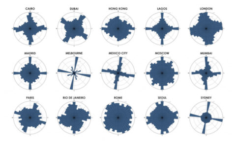
Geoff Boeing, Urban planning professor at Northeastern University, has developed a tool to visualize the consistency of a city’s street network. Boeing’s tool calculates what percentage of a city’s roads run along each section of a compass, and plots it on a circular bar chart. A similar concept was created recently by data scientist Seth